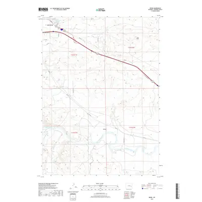
2018 Map of Irvine
USGS Topo · Published 2018About this map
The North Platte River winds through the heart of this Converse County landscape, anchoring the transition between the developed outskirts of Douglas and the smaller settlement at Irvine. The mapping shows a complex network of ranching and transit corridors, where E Yellowstone Hwy and Orin Way parallel the river's course across the high plains. Local water management is evident at the Runden Number 1 Reservoir in the northwest, while numerous drainages including La Bonte Cr, Wagon Hound Cr, and Sand Creek feed the river system.
Find a feature on this map
27 named features on this map. Tap any name to fly to it.
Don’t see what you’re looking for? This feature index may not catch every label — zoom into the map to look around manually.
Map Details
Editions of this 2018 Irvine Map
This is the sole edition of this map. No revisions or reprints were ever made.
Other maps of this area

1949 · Irvine
USGS Topo · 1:24,000

1949 · Poison Lake
USGS Topo · 1:24,000

1949 · Cedar Hill
USGS Topo · 1:24,000

1949 · Douglas
USGS Topo · 1:24,000

1949 · Dilts Ranch
USGS Topo · 1:24,000

1949 · Chalk Buttes
USGS Topo · 1:24,000

1949 · Orin
USGS Topo · 1:24,000

1949 · Antelope Creek
USGS Topo · 1:24,000

1950 · Poison Lake
USGS Topo · 1:24,000

1950 · Douglas
USGS Topo · 1:24,000