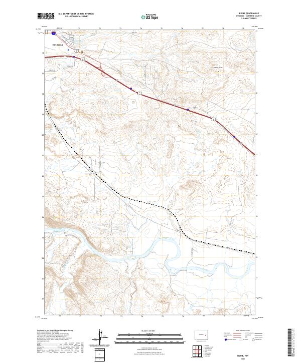
2021 Map of Irvine
USGS Topo · Published 2021About this map
Douglas serves as the primary urban anchor in this corner of Converse County, where residential streets like Cheyenne St and Richards St meet the corridor of the E Yellowstone Hwy. The landscape is defined by the sweeping curves of the North Platte River as it meanders through the southern half of the quadrangle, joined by tributaries such as Wagon Hound Cr and La Bonte Cr. This 2021 survey illustrates a modern rural infrastructure where established thoroughfares like Irvine Rd and the Irvine Bridge Rd connect ranch lands to the regional transport network. To the north, the terrain transitions into more pronounced relief at Miller Draw, with landmarks like the Runden Number 1 Reservoir providing essential water management for the high plains environment.
Find a feature on this map
27 named features on this map. Tap any name to fly to it.
Don’t see what you’re looking for? This feature index may not catch every label — zoom into the map to look around manually.
Map Details
Editions of this 2021 Irvine Map
This is the sole edition of this map. No revisions or reprints were ever made.
Other maps of this area

1949 · Irvine
USGS Topo · 1:24,000

1949 · Poison Lake
USGS Topo · 1:24,000

1949 · Cedar Hill
USGS Topo · 1:24,000

1949 · Douglas
USGS Topo · 1:24,000

1949 · Dilts Ranch
USGS Topo · 1:24,000

1949 · Chalk Buttes
USGS Topo · 1:24,000

1949 · Orin
USGS Topo · 1:24,000

1949 · Antelope Creek
USGS Topo · 1:24,000

1950 · Poison Lake
USGS Topo · 1:24,000

1950 · Douglas
USGS Topo · 1:24,000