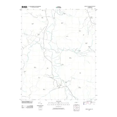
2010 Map of Irving College
USGS Topo · Published 2010About this map
The Collins River snakes through this Warren County landscape, defining a valley defined by deep coves and prominent ridges. To the north, the terrain is shaped by features like Hughes Cove and Safley Hollow, while the river itself provides historic crossing points such as Martins Ford. Local industry is evidenced by the presence of the Badger Mine near Knowles Ridge and the Grissom Quarry at the northern edge of the survey.
Find a feature on this map
70 named features on this map. Tap any name to fly to it.
Don’t see what you’re looking for? This feature index may not catch every label — zoom into the map to look around manually.
Map Details
Editions of this 2010 Irving College Map
This is the sole edition of this map. No revisions or reprints were ever made.
Other maps of this area

1893 · Mc Minnville
USGS Topo · 1:125,000

1895 · Mc Minnville
USGS Topo · 1:125,000

1895 · Sewanee
USGS Topo · 1:125,000

1936 · Cane Hollow
USGS Topo · 1:24,000

1943 · Mc Minnville
USGS Topo · 1:100,000

1953 · Chattanooga
USGS Topo · 1:250,000

1953 · Mc Minnville
USGS Topo · 1:24,000
1955 · Viola
USGS Topo · 1:24,000
1956 · Collins
USGS Topo · 1:24,000
1956 · Altamont
USGS Topo · 1:24,000