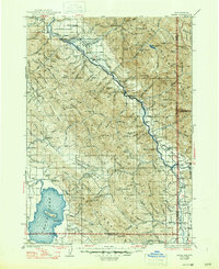
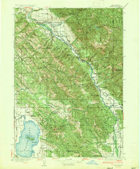
1935 Map of Irwin
USGS Topo · Published 1947About this map
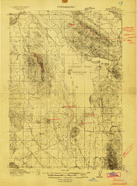
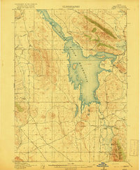
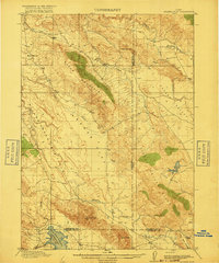
The Snake River carves a deep valley through the Teton National Forest in this mid-1930s survey of the Idaho-Wyoming border. Small settlements like Irwin and Swan Valley anchor the riverfront, while the Caribou Range rises to the south, home to the high-elevation mining site of Caribou City. The landscape is a network of forest service infrastructure and rural school districts, including the Fidelity and Blowout schools. To the southwest, the expansive Gray's Lake dominates the high plateau, managed by the Grays Lake Ranger Station. Before modern damming altered the local hydrology, transit relied on crossings like Edwards Ferry, and the economy was supported by sites like Weeks Sawmill near Baldy Mountain. The map also captures the Boise Base Line as it intersects this complex terrain of ridges and basins.
Find a feature on this map
113 named features on this map. Tap any name to fly to it.
Don’t see what you’re looking for? This feature index may not catch every label — zoom into the map to look around manually.
Map Details
Editions of this 1935 Irwin Map
3 editions found

Other maps of this area

1899 · Grand Teton
USGS Topo · 1:125,000

1901 · Grand Teton
USGS Topo · 1:125,000
1914 · Henry
USGS Topo · 1:48,000

1915 · Freedom
USGS Topo · 1:62,500

1915 · Lanes Creek
USGS Topo · 1:62,500
1916 · Henry
USGS Topo · 1:62,500
1917 · Cranes Flat
USGS Topo · 1:62,500

1921 · Afton
USGS Topo · 1:125,000

1924 · Hell Creek
USGS Topo · 1:62,500

1926 · Hell Creek
USGS Topo · 1:62,500