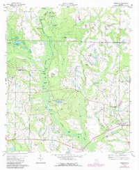
1973 Map of Irwinville
USGS Topo · Published 1987About this map
The Alapaha River creates a meandering natural corridor through this south Georgia landscape, defining the boundary between Irwin and Turner counties. The area is characterized by a high density of named ponds and lakes, such as White Oak Lake, Brickyard Lake, and Burnt Island Lake, suggesting a terrain shaped by lime sinks and natural depressions common to the coastal plain. In the southeast, the historic settlement of Irwinville sits near the Jefferson Davis Memorial County Park, marking a significant site of Civil War history. The map captures the balance between agricultural development and the native riverine environment, with river crossings like Turner Lake Ford and Flat Ford still noted alongside more modern features like the Crystal Lake Airpark. Rural life is anchored by local landmarks including Big Creek Ch and several family-named ponds that reflect generations of land use.
Find a feature on this map
51 named features on this map. Tap any name to fly to it.
Don’t see what you’re looking for? This feature index may not catch every label — zoom into the map to look around manually.
Map Details
Editions of this 1973 Irwinville Map
2 editions found
Other maps of this area

1953 · Waycross
USGS Topo · 1:250,000

1958 · Waycross
USGS Topo · 1:250,000

1973 · Ocilla West
USGS Topo · 1:24,000

1973 · Waterloo
USGS Topo · 1:24,000

1973 · Irwinville
USGS Topo · 1:24,000

1973 · Chula
USGS Topo · 1:24,000

1973 · Bethel
USGS Topo · 1:24,000

1973 · Fitzgerald West
USGS Topo · 1:24,000

1974 · Rebecca
USGS Topo · 1:24,000

1974 · Amboy
USGS Topo · 1:24,000