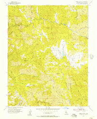
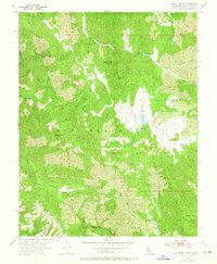
1955 Map of Isabel Valley
USGS Topo · Published 1957About this map
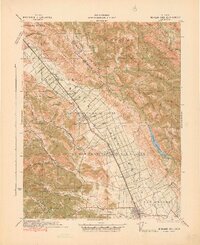
Lick Observatory stands as a prominent landmark on the western edge of this mid-century survey, overlooking the complex terrain of the Diablo Range. The map detail centers on the Isabel Valley and the sprawling Los Huecos land grant area, characterized by a dense network of ridges such as Bollinger Ridge and Hays Ridge. While the landscape is primarily dominated by natural features like Mt Isabel and Mt Helen, the map records essential infrastructure of the era, including a remote Landing Strip and a series of primitive jeep trails. Water management in this arid environment is evident through several named reservoirs and the drainage systems of Horse Valley Creek and the Middle Fork Coyote Creek. Small named locales like Indian Springs and Grizzly Flats provide specific points of interest for local history researchers tracking land use and early settlements in Santa Clara County.
Find a feature on this map
55 named features on this map. Tap any name to fly to it.
Don’t see what you’re looking for? This feature index may not catch every label — zoom into the map to look around manually.
Map Details
Editions of this 1955 Isabel Valley Map
3 editions found

Other maps of this area

1897 · Mt. Hamilton
USGS Topo · 1:62,500

1917 · Morgan Hill
USGS Topo · 1:62,500
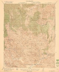
1921 · Gilroy Hot Springs
USGS Topo · 1:62,500
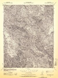
1938 · Mt. Boardman
USGS Topo · 1:62,500

1939 · Morgan Hill
USGS Topo · 1:62,500

1939 · Gilroy Hot Springs
USGS Topo · 1:62,500

1940 · Gilroy Hot Springs
USGS Topo · 1:62,500
1941 · Morgan Hill
USGS Topo · 1:62,500

1942 · Mt. Hamilton
USGS Topo · 1:62,500

1942 · Mt. Boardman
USGS Topo · 1:62,500