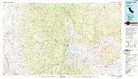
1978 Map of Isabella Lake
USGS Topo · Published 1994About this map
Isabella Lake dominates this mountain landscape at the junction of the Kern River and its South Fork. The surrounding terrain transitions from the high peaks of the Greenhorn Mountains and Piute Mountains to the eastern desert foothills. Local history researchers can find several scattered high-elevation settlements, including Panorama Heights and Johnsondale, reflecting the area's history of logging and recreation within the Sequoia National Forest.
Find a feature on this map
77 named features on this map. Tap any name to fly to it.
Don’t see what you’re looking for? This feature index may not catch every label — zoom into the map to look around manually.
Map Details
Editions of this 1978 Isabella Lake Map
2 editions found
Other maps of this area

1904 · Kaweah
USGS Topo · 1:125,000

1905 · Olancha
USGS Topo · 1:125,000

1905 · Fairview
USGS Topo · 1:24,000

1906 · Bakersfield
USGS Topo · 1:62,500

1906 · Kernville
USGS Topo · 1:125,000

1907 · Olancha
USGS Topo · 1:125,000

1908 · Kernville
USGS Topo · 1:125,000

1908 · Ballarat
USGS Topo · 1:250,000

1909 · Kaweah
USGS Topo · 1:125,000

1910 · Buena Vista Lake
USGS Topo · 1:125,000