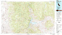
1978 Map of Isabella Lake
USGS Topo · Published 1994About this map
Isabella Lake serves as the central focal point for this late 1970s landscape, where the Kern River and its South Fork meet amidst the high peaks of the Greenhorn Mountains and Piute Mountains. The map documents a rugged interior of Kern County, showing the cluster of shoreline communities including Kernville, Wofford Heights, and Lake Isabella. To the south, the historical settlement of Havilah and the Long Tom Mine reflect the region's long-standing mining and ranching heritage. The geography is largely defined by public lands, spanning from the Tule River Indian Reservation in the north to the Dome Land Wilderness in the east. Notable landmarks like Miracle Hot Springs and California Hot Springs highlight the geothermal character of the terrain, while numerous gulches and canyons such as Grizzly Gulch and Sycamore Canyon trace the drainage patterns leading into the South Fork Valley.
Find a feature on this map
73 named features on this map. Tap any name to fly to it.
Don’t see what you’re looking for? This feature index may not catch every label — zoom into the map to look around manually.
Map Details
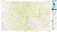
Editions of this 1978 Isabella Lake Map
2 editions found
Other maps of this area

1904 · Kaweah
USGS Topo · 1:125,000

1905 · Olancha
USGS Topo · 1:125,000

1905 · Fairview
USGS Topo · 1:24,000

1906 · Bakersfield
USGS Topo · 1:62,500

1906 · Kernville
USGS Topo · 1:125,000

1907 · Olancha
USGS Topo · 1:125,000

1908 · Kernville
USGS Topo · 1:125,000

1908 · Ballarat
USGS Topo · 1:250,000

1909 · Kaweah
USGS Topo · 1:125,000

1910 · Buena Vista Lake
USGS Topo · 1:125,000