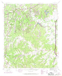
1945 Map of Isbell
USGS Topo · Published 1970About this map
Old Chickasaw Boundary lines the northern reaches of this landscape, marking a historical divide near the settlement of Belgreen. The terrain is characterized by a heavy industrial and agricultural presence during the mid-20th century, with several areas labeled as Strip Mine and a large Tailings pond near Cedar Creek. Transportation is anchored by the Southern railroad line and the Andrew Jackson Highway, which was noted as being under construction during the revision period.
Find a feature on this map
46 named features on this map. Tap any name to fly to it.
Don’t see what you’re looking for? This feature index may not catch every label — zoom into the map to look around manually.
Map Details
Editions of this 1945 Isbell Map
3 editions found
Other maps of this area

1924 · Tuscumbia
USGS Topo · 1:48,000

1925 · Barton
USGS Topo · 1:62,500

1926 · Tuscumbia
USGS Topo · 1:62,500

1926 · Barton
USGS Topo · 1:48,000

1929 · Barton
USGS Topo · 1:62,500

1936 · Russellville
USGS Topo · 1:24,000

1936 · Frankfort
USGS Topo · 1:24,000

1936 · Pleasant Grove
USGS Topo · 1:24,000

1936 · Hodges
USGS Topo · 1:24,000

1936 · Isbell
USGS Topo · 1:24,000