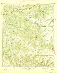
1947 Map of Isbell
USGS Topo · Published 1947About this map
Belgreen and the limestone-rich corridor of Rockwood anchor this mid-century portrait of Franklin County, Alabama. The landscape is defined by the heavy industry of the era, visible in the numerous Strip Mine operations that pock the hillsides near Isbell and north of Cedar Creek. These excavations contrast with a deeply rural social fabric represented by local gathering points like New Friendship Ch, Pleasant Hill Sch, and Mt Hebron Ch.
Find a feature on this map
63 named features on this map. Tap any name to fly to it.
Don’t see what you’re looking for? This feature index may not catch every label — zoom into the map to look around manually.
Map Details
Editions of this 1947 Isbell Map
2 editions found
Other maps of this area

1924 · Tuscumbia
USGS Topo · 1:48,000

1925 · Barton
USGS Topo · 1:62,500

1926 · Tuscumbia
USGS Topo · 1:62,500

1926 · Barton
USGS Topo · 1:48,000

1929 · Barton
USGS Topo · 1:62,500

1936 · Russellville
USGS Topo · 1:24,000

1936 · Frankfort
USGS Topo · 1:24,000

1936 · Pleasant Grove
USGS Topo · 1:24,000

1936 · Hodges
USGS Topo · 1:24,000

1936 · Isbell
USGS Topo · 1:24,000