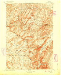
1899 Map of Ishawooa
USGS Topo · Published 1909About this map
Stinkingwater Mining Region anchors the southeastern corner of this high-altitude landscape, signaling the prospecting interests that drove early exploration of the Absaroka Range. Surveyed in 1893, the terrain is a complex of deep canyons and massive plateaus, including the Trident Plateau and Thorofare Plateau. The map highlights a critical junction of three early federal land designations: the Shoshone National Forest, Teton National Forest, and the eastern boundary of Yellowstone National Park.
Find a feature on this map
58 named features on this map. Tap any name to fly to it.
Don’t see what you’re looking for? This feature index may not catch every label — zoom into the map to look around manually.
Map Details
Editions of this 1899 Ishawooa Map
4 editions found

Other maps of this area

1885 · Lake
USGS Topo · 1:125,000

1886 · Canyon
USGS Topo · 1:125,000

1893 · Ishawooa
USGS Topo · 1:125,000

1895 · Ishawooa
USGS Topo · 1:125,000

1895 · Canyon
USGS Topo · 1:125,000

1895 · Lake
USGS Topo · 1:125,000

1896 · Lake
USGS Topo · 1:125,000

1896 · Canyon
USGS Topo · 1:125,000

1896 · Crandall Creek
USGS Topo · 1:125,000

1899 · Crandall
USGS Topo · 1:125,000