
1899 Map of Ishawooa
USGS Topo · Published 1899About this map
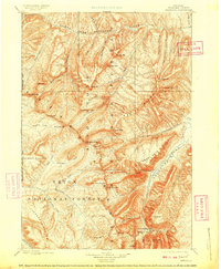
The Shoshone Range and Absaroka Range dominate this late-nineteenth-century landscape, characterized by towering peaks and deep river drainages just east of the Yellowstone National Park boundary. To the south, the Stinkingwater Mining Region highlights the era’s prospecting activity, situated near Needle Mt. and the headwaters of Needle Creek. This rugged terrain was surveyed by Frank Tweedy in 1893, documenting a wilderness of massive tablelands like Sheep Mesa and Ishawooa Mesa. The drainage patterns are defined by the North Fork Stinkingwater River in the north and the complex network of Thorofare Creek to the southwest. These high-altitude corridors, including Ishawooa Pass, provided critical transit points through the mountains before the establishment of modern infrastructure.
Find a feature on this map
60 named features on this map. Tap any name to fly to it.
Don’t see what you’re looking for? This feature index may not catch every label — zoom into the map to look around manually.
Map Details
Editions of this 1899 Ishawooa Map
4 editions found
Other maps of this area

1885 · Lake
USGS Topo · 1:125,000

1886 · Canyon
USGS Topo · 1:125,000

1893 · Ishawooa
USGS Topo · 1:125,000

1895 · Ishawooa
USGS Topo · 1:125,000

1895 · Canyon
USGS Topo · 1:125,000

1895 · Lake
USGS Topo · 1:125,000

1896 · Lake
USGS Topo · 1:125,000

1896 · Canyon
USGS Topo · 1:125,000

1896 · Crandall Creek
USGS Topo · 1:125,000

1899 · Crandall
USGS Topo · 1:125,000