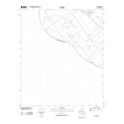
2010 Map of Isla
USGS Topo · Published 2010About this map
The international boundary between Texas and Chihuahua follows the winding course of the Rio Grande through this river-valley landscape. Settlement patterns on the American side are defined by a dense network of irrigation and drainage infrastructure, including the Guadalupe Lateral and the Border Drain, which supported the agricultural development of the region near Fabens. Smaller communities like Isla and Elizario are connected by a series of family-named and descriptive routes, such as Jess Harris Rd and Island Rd. The topography is relatively flat, emphasizing the significance of the river crossing at Guadalupe Bridge and the Tornillo Spur rail line. This survey captures a moment of modern land management in the El Paso Valley, where the grid of local roads like Wilson Rd and R C Elam Rd meet the natural curve of the historic river channel.
Find a feature on this map
21 named features on this map. Tap any name to fly to it.
Don’t see what you’re looking for? This feature index may not catch every label — zoom into the map to look around manually.
Map Details
Editions of this 2010 Isla Map
This is the sole edition of this map. No revisions or reprints were ever made.
Other maps of this area

1896 · El Paso
USGS Topo · 1:125,000

1896 · Rio Grande
USGS Topo · 1:125,000

1908 · El Paso
USGS Topo · 1:125,000

1939 · Ysleta
USGS Topo · 1:62,500

1941 · Clint
USGS Topo · 1:62,500

1941 · Ysleta
USGS Topo · 1:62,500

1941 · Tornillo
USGS Topo · 1:62,500

1945 · Ysleta
USGS Topo · 1:62,500
1945 · Clint
USGS Topo · 1:62,500
1945 · Tornillo
USGS Topo · 1:62,500