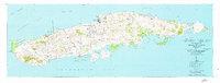
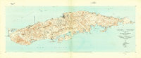
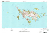
1951 Map of Island Of Vieques
USGS Topo · Published 1951This historical map portrays the area of Island Of Vieques in 1951, primarily covering Humacao Municipio as well as portions of Ceiba Municipio and Vieques Municipio. Featuring a scale of 1:30000, this map provides a highly detailed snapshot of the terrain, roads, buildings, counties, and historical landmarks in the Island Of Vieques region at the time. Published in 1951, it is one of 5 known editions of this map due to revisions or reprints.
Find a feature on this map
88 named features on this map. Tap any name to fly to it.
Don’t see what you’re looking for? This feature index may not catch every label — zoom into the map to look around manually.
Map Details
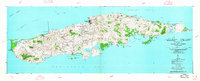
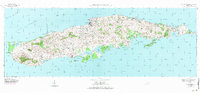
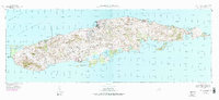
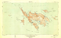
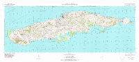
Editions of this 1951 Island Of Vieques Map
5 editions found
Historical Maps of Monte Carmelo Through Time
7 maps found
1943 Island Of Vieques
Humacao Municipio, PR
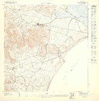
1947 Humacao SE
Humacao Municipio, PR
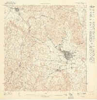
1947 Humacao SO
Humacao Municipio, PR
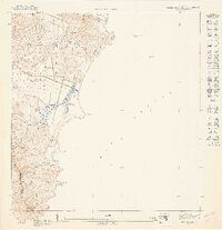
1947 Punta Guayanes NE
Humacao Municipio, PR
1948 Culebra And Adjacent Islands
Humacao Municipio, PR
1950 Culebra And Adjacent Islands
Humacao Municipio, PR
1951 Isla De Vieques
Humacao Municipio, PR
Featured Locations
- Quintas de Santa Elena, Vieques
- Bravos de Boston, Vieques
- El Pilón, Vieques
- Isabel Segunda, Vieques
- La Hueca, Vieques