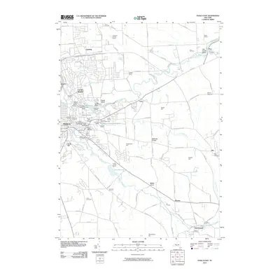
2010 Map of Ithaca East
USGS Topo · Published 2010About this map
Cornell University anchors this portion of the Finger Lakes region, where the steep gorges of Fall Creek and Cascadilla Creek define the local topography. This landscape is marked by a high concentration of engineered crossings, from the historic Stewart Avenue Bridge to the Triphammer Foot Bridge and the College Avenue Arch Bridge. Beyond the campus and the residential neighborhoods of Cayuga Heights and Forest Home, the terrain rises toward Turkey Hill and Mount Pleasant, transitioning into a landscape of small settlements and agricultural sites like the Dilmun Hill Student Organic Farm and Cornell Orchards. To the southeast, the course of Sixmile Creek flows through the Ithaca Reservoir toward Brooktondale, passing family-named landmarks such as the Roe Cemetery and the Six Mile Creek Vineyard.
Find a feature on this map
115 named features on this map. Tap any name to fly to it.
Don’t see what you’re looking for? This feature index may not catch every label — zoom into the map to look around manually.
Map Details
Editions of this 2010 Ithaca East Map
This is the sole edition of this map. No revisions or reprints were ever made.
Other maps of this area

1893 · Ithaca
USGS Topo · 1:62,500

1895 · Ithaca
USGS Topo · 1:62,500

1898 · Moravia
USGS Topo · 1:62,500

1900 · Dryden
USGS Topo · 1:62,500

1902 · Moravia
USGS Topo · 1:62,500

1902 · Genoa
USGS Topo · 1:62,500

1905 · Watkins Glen
USGS Topo · 1:125,000

1906 · Catatonk
USGS Topo · 1:125,000

1942 · Ludlowville
USGS Topo · 1:24,000

1942 · Groton
USGS Topo · 1:24,000