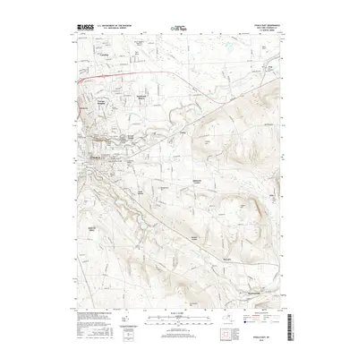
2016 Map of Ithaca East
USGS Topo · Published 2016About this map
Cornell Univ anchors the center of this landscape, its sprawling campus defined by the dramatic gorges of Fall Creek and Cascadilla Creek. The map documents the residential development of surrounding communities like Cayuga Heights, Northeast Ithaca, and the historic enclave of Forest Home. To the south and east, the terrain rises toward Snyder Hill and Turkey Hill, where the suburban density of the city gives way to the more rural character of Hibbards Corner and Ellis.
Find a feature on this map
177 named features on this map. Tap any name to fly to it.
Don’t see what you’re looking for? This feature index may not catch every label — zoom into the map to look around manually.
Map Details
Editions of this 2016 Ithaca East Map
This is the sole edition of this map. No revisions or reprints were ever made.
Other maps of this area

1893 · Ithaca
USGS Topo · 1:62,500

1895 · Ithaca
USGS Topo · 1:62,500

1898 · Moravia
USGS Topo · 1:62,500

1900 · Dryden
USGS Topo · 1:62,500

1902 · Moravia
USGS Topo · 1:62,500

1902 · Genoa
USGS Topo · 1:62,500

1905 · Watkins Glen
USGS Topo · 1:125,000

1906 · Catatonk
USGS Topo · 1:125,000

1942 · Ludlowville
USGS Topo · 1:24,000

1942 · Groton
USGS Topo · 1:24,000