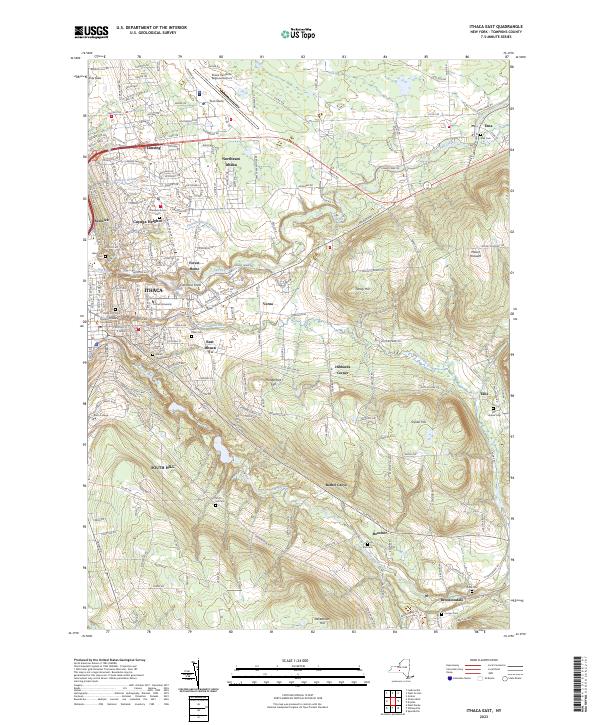
2023 Map of Ithaca East
USGS Topo · Published 2023About this map
Ithaca and its immediate eastern outskirts appear here in a period of modern expansion, centered on the prestigious grounds of Cornell University and the scenic ravines of Cascadilla Creek and Fall Creek. The landscape transitions from the urban core and the Ithaca College campus in the southwest toward the high ridges of South Hill, Snyder Hill, and Turkey Hill. This geography has long dictated the layout of the region, with older settlements like Forest Home and Varna following the waterway's paths, while modern development reaches north toward Lansing and Northeast Ithaca.
Find a feature on this map
202 named features on this map. Tap any name to fly to it.
Don’t see what you’re looking for? This feature index may not catch every label — zoom into the map to look around manually.
Map Details
Editions of this 2023 Ithaca East Map
This is the sole edition of this map. No revisions or reprints were ever made.
Other maps of this area

1893 · Ithaca
USGS Topo · 1:62,500

1895 · Ithaca
USGS Topo · 1:62,500

1898 · Moravia
USGS Topo · 1:62,500

1900 · Dryden
USGS Topo · 1:62,500

1902 · Moravia
USGS Topo · 1:62,500

1902 · Genoa
USGS Topo · 1:62,500

1905 · Watkins Glen
USGS Topo · 1:125,000

1906 · Catatonk
USGS Topo · 1:125,000

1942 · Ludlowville
USGS Topo · 1:24,000

1942 · Groton
USGS Topo · 1:24,000