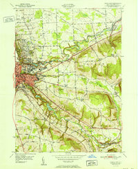
1951 Map of Ithaca East
USGS Topo · Published 1951About this map
Cornell University anchors the western edge of this mid-century survey, its campus situated between the dramatic gorges carved by Fall Creek and Cascadilla Creek. The city of Ithaca transitions into the steep terrain of Ithaca Hill and Snyder Hill, where the landscape is defined by the deep valley of Sixmile Creek and the Ithaca Reservoir. This era captures a mix of academic expansion and traditional rural life, with numerous numbered schoolhouses like School No 18 and School No 10 serving the outlying communities of Varna and Etna.
Find a feature on this map
76 named features on this map. Tap any name to fly to it.
Don’t see what you’re looking for? This feature index may not catch every label — zoom into the map to look around manually.
Map Details
Editions of this 1951 Ithaca East Map
This is the sole edition of this map. No revisions or reprints were ever made.
Other maps of this area

1893 · Ithaca
USGS Topo · 1:62,500

1895 · Ithaca
USGS Topo · 1:62,500

1898 · Moravia
USGS Topo · 1:62,500

1900 · Dryden
USGS Topo · 1:62,500

1902 · Moravia
USGS Topo · 1:62,500

1902 · Genoa
USGS Topo · 1:62,500

1905 · Watkins Glen
USGS Topo · 1:125,000

1906 · Catatonk
USGS Topo · 1:125,000

1942 · Ludlowville
USGS Topo · 1:24,000

1942 · Groton
USGS Topo · 1:24,000