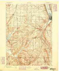
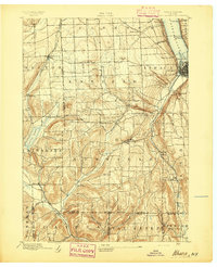
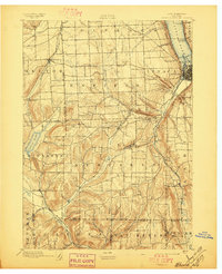
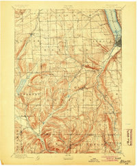
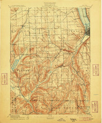
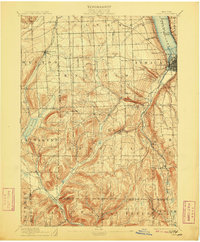
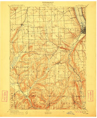
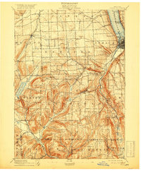
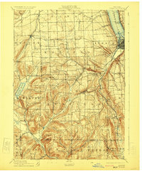
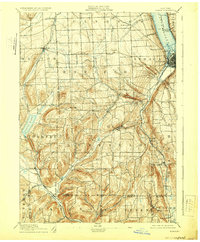
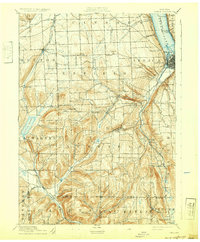
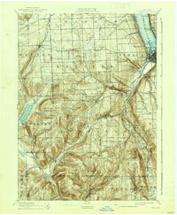
1895 Map of Ithaca
USGS Topo · Published 1899About this map
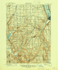
Ithaca anchors the northeastern corner of this 1890s landscape, positioned where Fall Creek and the southern tip of Cayuga Lake meet the steep topography of the Finger Lakes region. The Lehigh Valley R. R. follows the lake shore and cuts through the valley floors, providing a vital transportation artery through the townships of Ulysses, Enfield, and Newfield. The terrain is defined by dramatic elevation changes, evidenced by the presence of Buttermilk Falls and the secluded waters of Cayuta Lake to the west.
Find a feature on this map
60 named features on this map. Tap any name to fly to it.
Don’t see what you’re looking for? This feature index may not catch every label — zoom into the map to look around manually.
Map Details
Editions of this 1895 Ithaca Map
13 editions found
1895 edition
17 x 20.9 inches
1897 edition
17 x 21 inches
1899 edition
16.6 x 20.2 inches
1904 edition
16.6 x 20.1 inches
1906 edition
16.6 x 20.1 inches
1909 edition
16.6 x 20.1 inches
1912 edition
16.6 x 20.1 inches
1918 edition
16.6 x 20.1 inches
1923 edition
16.6 x 20.2 inches
1929 edition
16.6 x 20.1 inches
1932 edition
16.6 x 20.1 inches
1938 edition
16.6 x 20.1 inches
1946 edition
17 x 20.8 inches
