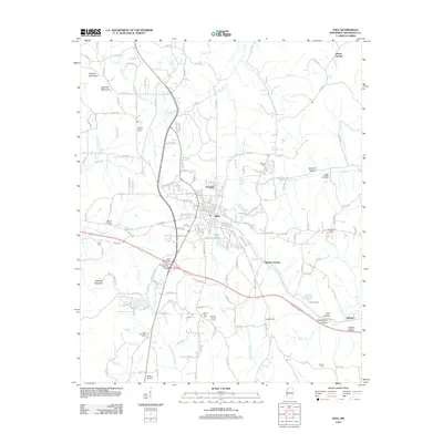
2012 Map of Iuka
USGS Topo · Published 2012About this map
Iuka sits at the heart of this Tishomingo County landscape, where the Norfolk Southern railroad and several state highways converge. The terrain is defined by a dense network of local creeks and branches, including Indian Cr, Clear Cr, and Little Cripple Deer Cr. To the southwest, Woodall Mountain rises as a prominent landmark, while the surrounding countryside is dotted with small communities like Pinedale, Oldham, and Blythe Crossing. Genealogists and local historians will find numerous burial sites mapped, ranging from Toenail Cem and Snowdown Cem to Moores Chapel Cem and Mount Joy Cem. Near the rail line, industrial and logistical points such as Gravel Siding and Iuka Airport appear alongside historical commemorative sites like the John M Stone Memorial Marker, reflecting the area's diverse cultural and economic layers.
Find a feature on this map
171 named features on this map. Tap any name to fly to it.
Don’t see what you’re looking for? This feature index may not catch every label — zoom into the map to look around manually.
Map Details
Editions of this 2012 Iuka Map
This is the sole edition of this map. No revisions or reprints were ever made.
Other maps of this area

1911 · Iuka
USGS Topo · 1:48,000

1914 · Iuka
USGS Topo · 1:62,500

1935 · Holcut
USGS Topo · 1:24,000

1935 · Doskie
USGS Topo · 1:24,000

1935 · Iuka
USGS Topo · 1:24,000

1935 · Leedy
USGS Topo · 1:24,000

1936 · Margerum
USGS Topo · 1:24,000

1936 · Waterloo
USGS Topo · 1:24,000

1936 · Shaws
USGS Topo · 1:24,000

1936 · Bishop
USGS Topo · 1:24,000