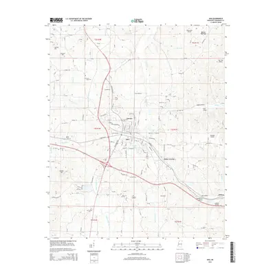
2015 Map of Iuka
USGS Topo · Published 2015About this map
Iuka serves as the focal point of this northeast Mississippi landscape, where the town's grid meets the Kansas City Southern railroad line. The surrounding Tishomingo County terrain is defined by a dense network of creek drainages, including Indian Cr and Little Cripple Deer Cr, which carve through a series of named hollows and ridges. Notable elevations like Woodall Mtn and Ashcraft Mtn rise above the valleys, providing a varied topography that has shaped local development and transit routes.
Find a feature on this map
178 named features on this map. Tap any name to fly to it.
Don’t see what you’re looking for? This feature index may not catch every label — zoom into the map to look around manually.
Map Details
Editions of this 2015 Iuka Map
This is the sole edition of this map. No revisions or reprints were ever made.
Other maps of this area

1911 · Iuka
USGS Topo · 1:48,000

1914 · Iuka
USGS Topo · 1:62,500

1935 · Holcut
USGS Topo · 1:24,000

1935 · Doskie
USGS Topo · 1:24,000

1935 · Iuka
USGS Topo · 1:24,000

1935 · Leedy
USGS Topo · 1:24,000

1936 · Margerum
USGS Topo · 1:24,000

1936 · Waterloo
USGS Topo · 1:24,000

1936 · Shaws
USGS Topo · 1:24,000

1936 · Bishop
USGS Topo · 1:24,000