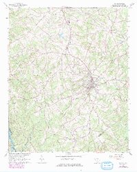
1964 Map of Iva
USGS Topo · Published 1979About this map
The Seaboard Coast Line railroad anchors the local economy of south Anderson County, connecting the small agrarian hubs of Starr and Iva. Photorevised in the late 1970s, this survey reveals a landscape shaped by a dense network of country roads and spiritual centers, such as Hebron Ch and Goodhope Ch. The area is defined by its numerous waterways, including the Savannah River at the southwest corner and the many branches of Little Generostee Creek that carve through the countryside.
Find a feature on this map
30 named features on this map. Tap any name to fly to it.
Don’t see what you’re looking for? This feature index may not catch every label — zoom into the map to look around manually.
Map Details
Editions of this 1964 Iva Map
3 editions found
Other maps of this area

1893 · Elberton
USGS Topo · 1:125,000

1954 · Greenville
USGS Topo · 1:250,000

1958 · Greenville
USGS Topo · 1:250,000

1958 · Elberton
USGS Topo · 1:62,500

1959 · Hartwell Dam
USGS Topo · 1:24,000

1959 · Hartwell NE
USGS Topo · 1:24,000

1964 · Iva
USGS Topo · 1:24,000

1964 · Antreville
USGS Topo · 1:24,000

1964 · Lowndesville
USGS Topo · 1:24,000

1964 · Saylors Crossroads
USGS Topo · 1:24,000