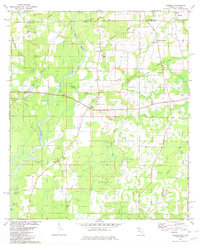
1982 Map of Izagora
USGS Topo · Published 1983About this map
The Alberson Stretch Choctawhatchee River defines the western reaches of this North Florida landscape, where the state line meets Geneva County. The terrain is shaped by an intricate network of water, from the braided paths of River Nines and Tiger Creek to the secluded Blackfish Lake and Blue Lake. Small communities and agricultural hubs like Izagora and Smith Crossroads anchor the road network, which winds past numerous country churches that served as the social backbone of the region.
Find a feature on this map
38 named features on this map. Tap any name to fly to it.
Don’t see what you’re looking for? This feature index may not catch every label — zoom into the map to look around manually.
Map Details
Editions of this 1982 Izagora Map
2 editions found
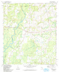
Other maps of this area

1942 · Enterprise
USGS Topo · 1:125,000

1949 · Hobbs Crossroads
USGS Topo · 1:24,000

1949 · Caryville
USGS Topo · 1:24,000

1950 · Hobbs Cross Roads
USGS Topo · 1:24,000

1950 · Prosperity
USGS Topo · 1:24,000

1950 · Caryville
USGS Topo · 1:24,000

1950 · Izagora
USGS Topo · 1:24,000

1950 · Esto
USGS Topo · 1:24,000

1951 · Esto
USGS Topo · 1:24,000

1951 · Bonifay
USGS Topo · 1:24,000