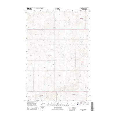
2014 Map of Jack Creek NW
USGS Topo · Published 2014About this map
The high plains of Custer County are defined by a complex drainage network including Moon Cr and its tributaries, as seen in this 2014 survey. The area is characterized by the Public Land Survey System township and range divisions, such as t5n r46e and t5n r47e, which dictate the rural property boundaries and ranching layout of this Montana landscape. Water sources remain the primary landmarks for local navigation and land use, with Corral Cr and Plunket Cr cutting through the topography. Other smaller drainages like Thorpe Cr, Kennedy Cr, and Geddes Cr provide additional points of reference for those tracing historical land claims or geographical shifts in the early 21st century.
Find a feature on this map
14 named features on this map. Tap any name to fly to it.
Don’t see what you’re looking for? This feature index may not catch every label — zoom into the map to look around manually.
Map Details
Editions of this 2014 Jack Creek NW Map
This is the sole edition of this map. No revisions or reprints were ever made.
Other maps of this area

1953 · Miles City
USGS Topo · 1:250,000

1954 · Forsyth
USGS Topo · 1:250,000

1957 · Miles City
USGS Topo · 1:250,000

1957 · Forsyth
USGS Topo · 1:250,000

1958 · Miles City
USGS Topo · 1:250,000

1958 · Forsyth
USGS Topo · 1:250,000

1968 · Lignite Creek
USGS Topo · 1:24,000

1968 · Paddy Fay Creek
USGS Topo · 1:24,000

1968 · Horton
USGS Topo · 1:24,000
1969 · Jack Creek NW
USGS Topo · 1:24,000