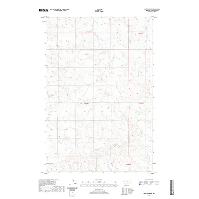
2020 Map of Jack Creek NW
USGS Topo · Published 2020About this map
Moon Creek Divide Rd traverses the southern reaches of this Custer County landscape, following the high ground between complex drainage systems. The area is defined by an intricate network of seasonal waterways, including the winding Moon Cr and its tributary, E Fork Moon Cr. These creek beds and their surrounding breaks illustrate the land-use patterns of eastern Montana, where the terrain dictates the paths of travel and the location of ranching boundaries. Further south, the map details the headwaters of Geddes Cr and Kennedy Cr, providing a clear view of the topographical transitions within Township 4 North and Township 5 North. The absence of major settlements highlights the rural character of this region, where place names are almost exclusively tied to the hydrology of the plains, such as Plunket Cr and Thorpe Cr.
Find a feature on this map
15 named features on this map. Tap any name to fly to it.
Don’t see what you’re looking for? This feature index may not catch every label — zoom into the map to look around manually.
Map Details
Editions of this 2020 Jack Creek NW Map
This is the sole edition of this map. No revisions or reprints were ever made.
Other maps of this area

1953 · Miles City
USGS Topo · 1:250,000

1954 · Forsyth
USGS Topo · 1:250,000

1957 · Miles City
USGS Topo · 1:250,000

1957 · Forsyth
USGS Topo · 1:250,000

1958 · Miles City
USGS Topo · 1:250,000

1958 · Forsyth
USGS Topo · 1:250,000

1968 · Lignite Creek
USGS Topo · 1:24,000

1968 · Paddy Fay Creek
USGS Topo · 1:24,000

1968 · Horton
USGS Topo · 1:24,000
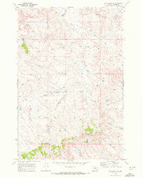
1969 · Jack Creek NW
USGS Topo · 1:24,000