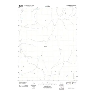
2010 Map of Jack Henry Knoll
USGS Topo · Published 2010About this map
Jack Henry Knoll rises as a prominent landmark within this high-desert portion of the Black Mountains in Iron County. This 2010 survey illustrates a landscape defined by seasonal water sources and rugged drainage patterns, including Jackrabbit Wash and Kane Spring Wash. The presence of numerous isolated water points such as Ryan Spring, Lister Spring, and Guyman Seep indicates the critical role of specific springs for livestock or wildlife in this arid terrain. Topographically, the map transitions from the high peaks of Chipman Peak down toward the southern expanse of the Parowan Valley. The winding route of North Hills Beach Rd provides one of the few navigational corridors through the Red Hills, connecting remote canyons like Poorman Ranch Canyon to the broader valley floor.
Find a feature on this map
24 named features on this map. Tap any name to fly to it.
Don’t see what you’re looking for? This feature index may not catch every label — zoom into the map to look around manually.
Map Details
Editions of this 2010 Jack Henry Knoll Map
This is the sole edition of this map. No revisions or reprints were ever made.
Other maps of this area

1885 · Beaver
USGS Topo · 1:250,000

1886 · Kanab
USGS Topo · 1:250,000

1953 · Minersville
USGS Topo · 1:24,000

1953 · Richfield
USGS Topo · 1:250,000

1953 · Cedar City
USGS Topo · 1:250,000

1958 · Richfield
USGS Topo · 1:250,000

1958 · Cedar City
USGS Topo · 1:250,000

1958 · Minersville
USGS Topo · 1:62,500

1962 · Cedar City
USGS Topo · 1:250,000

1971 · Buckhorn Flat
USGS Topo · 1:24,000