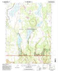
1993 Map of Jacks Butte
USGS Topo · Published 1997About this map
Jacks Butte stands as a prominent topographical feature in this high-altitude landscape of the Modoc National Forest. The 1993 field check reveals a terrain heavily defined by water management and natural wetlands, from the expansive Fairchild Swamp and Antelope Plains to a network of seasonal catchments like Antelope Reservoir and Dobe Swale Reservoir. The presence of many Dry Lakes and numerous springs, such as Pine Spring and Essex Spring, suggests a hydrology that is highly dependent on seasonal snowmelt and runoff.
Find a feature on this map
24 named features on this map. Tap any name to fly to it.
Don’t see what you’re looking for? This feature index may not catch every label — zoom into the map to look around manually.
Map Details
Editions of this 1993 Jacks Butte Map
2 editions found
Other maps of this area

1886 · Alturas
USGS Topo · 1:250,000

1892 · Alturas
USGS Topo · 1:250,000

1954 · Alturas
USGS Topo · 1:250,000

1958 · Alturas
USGS Topo · 1:250,000

1961 · Canby
USGS Topo · 1:62,500

1961 · Alturas
USGS Topo · 1:62,500

1962 · Alturas
USGS Topo · 1:250,000

1962 · Big Sage Reservoir
USGS Topo · 1:62,500

1962 · Jacks Butte
USGS Topo · 1:62,500

1965 · Alturas
USGS Topo · 1:250,000