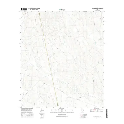
2016 Map of Jacks Creek North
USGS Topo · Published 2016About this map
The Tyler and Polk County line cuts diagonally across this East Texas landscape, dividing a densely forested and creek-veined region. The terrain is defined by an intricate drainage system where Jacks Creek flows alongside major tributaries like Big Cypress Creek and Hickory Creek. This 2016 survey illustrates the modern rural infrastructure of the area, anchored by a network of timber and county roads. Numerous family and local identifiers appear in the road names, such as Midway Cemetery Rd, Buddy Lloyd Rd, and Driskell Rd. The presence of Race Track Rd and various spurs like Timber Rd suggest a landscape shaped by both local recreation and the long-standing timber industry common to this part of the Texas Piney Woods.
Find a feature on this map
26 named features on this map. Tap any name to fly to it.
Don’t see what you’re looking for? This feature index may not catch every label — zoom into the map to look around manually.
Map Details
Editions of this 2016 Jacks Creek North Map
This is the sole edition of this map. No revisions or reprints were ever made.
Other maps of this area

1954 · Beaumont
USGS Topo · 1:250,000

1955 · Woodville
USGS Topo · 1:62,500

1955 · Camden
USGS Topo · 1:62,500

1957 · Beaumont
USGS Topo · 1:250,000

1958 · Segno
USGS Topo · 1:62,500

1958 · Warren
USGS Topo · 1:62,500

1984 · Segno
USGS Topo · 1:24,000

1984 · Hortense
USGS Topo · 1:24,000

1984 · Beaumont
USGS Topo · 1:250,000

1984 · Jacks Creek South
USGS Topo · 1:24,000