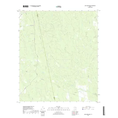
2019 Map of Jacks Creek North
USGS Topo · Published 2019About this map
The boundary between Polk and Tyler Counties bisects this landscape of creek drainages and rural timber tracks. Historically significant corridors like Midway Cemetery Rd and Race Track Rd suggest longstanding local landmarks and community centers. The terrain is defined by a dense network of waterways including Big Cypress Cr, Horsepen Cr, and Hickory Cr, which have historically influenced the movement of livestock and the timber industry in this corner of East Texas. A web of unpaved and county roads such as Buddy Lloyd Rd and Co Line Rd provides access to the interior woodlands, showing the modern footprint of land use in a region traditionally dominated by piney woods and agricultural smallholdings.
Find a feature on this map
26 named features on this map. Tap any name to fly to it.
Don’t see what you’re looking for? This feature index may not catch every label — zoom into the map to look around manually.
Map Details
Editions of this 2019 Jacks Creek North Map
This is the sole edition of this map. No revisions or reprints were ever made.
Other maps of this area

1954 · Beaumont
USGS Topo · 1:250,000

1955 · Woodville
USGS Topo · 1:62,500

1955 · Camden
USGS Topo · 1:62,500

1957 · Beaumont
USGS Topo · 1:250,000

1958 · Segno
USGS Topo · 1:62,500

1958 · Warren
USGS Topo · 1:62,500

1984 · Segno
USGS Topo · 1:24,000

1984 · Hortense
USGS Topo · 1:24,000

1984 · Beaumont
USGS Topo · 1:250,000

1984 · Jacks Creek South
USGS Topo · 1:24,000