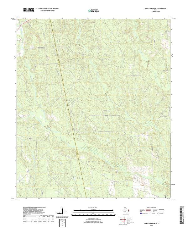
2022 Map of Jacks Creek North
USGS Topo · Published 2022About this map
Tyler and Polk Counties meet in this heavily wooded region of East Texas, where a dense network of creek beds defines the local topography. Waterways like Woods Cr, Horsepen Cr, and Big Cypress Cr cut through the landscape, indicating a terrain shaped by consistent drainage and seasonal flow. The layout of rural routes such as Midway Cemetery Rd and Race Track Rd suggests a dispersed settlement pattern tied to longstanding local thoroughfares and property boundaries.
Find a feature on this map
27 named features on this map. Tap any name to fly to it.
Don’t see what you’re looking for? This feature index may not catch every label — zoom into the map to look around manually.
Map Details
Editions of this 2022 Jacks Creek North Map
This is the sole edition of this map. No revisions or reprints were ever made.
Other maps of this area

1954 · Beaumont
USGS Topo · 1:250,000

1955 · Woodville
USGS Topo · 1:62,500

1955 · Camden
USGS Topo · 1:62,500

1957 · Beaumont
USGS Topo · 1:250,000

1958 · Segno
USGS Topo · 1:62,500

1958 · Warren
USGS Topo · 1:62,500

1984 · Segno
USGS Topo · 1:24,000

1984 · Hortense
USGS Topo · 1:24,000

1984 · Beaumont
USGS Topo · 1:250,000

1984 · Jacks Creek South
USGS Topo · 1:24,000