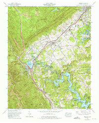
1973 Map of Jacksboro
USGS Topo · Published 1975About this map
Cumberland Mountain and Walden Ridge dominate the landscape in this 1970s survey, where industrial and recreational development meet at the foot of the ridge. The map documents the extensive presence of Strip mines cutting across the slopes of Cross Mountain and Fork Mountain, contrasting with the protected waters of Cove Lake State Park and Norris Lake. These major water bodies, created by dams, redefined the local topography and settlement patterns of towns like Jacksboro and La Follette.
Find a feature on this map
82 named features on this map. Tap any name to fly to it.
Don’t see what you’re looking for? This feature index may not catch every label — zoom into the map to look around manually.
Map Details
Editions of this 1973 Jacksboro Map
3 editions found
Other maps of this area

1893 · Briceville
USGS Topo · 1:125,000

1895 · Briceville
USGS Topo · 1:125,000

1896 · Briceville
USGS Topo · 1:125,000

1936 · Ivydell
USGS Topo · 1:24,000

1936 · Block
USGS Topo · 1:24,000

1936 · Jacksboro
USGS Topo · 1:24,000

1936 · Pioneer
USGS Topo · 1:24,000

1936 · Duncan Flats
USGS Topo · 1:24,000

1936 · La Follette
USGS Topo · 1:48,000

1936 · Norris Dam
USGS Topo · 1:48,000