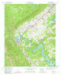
1973 Map of Jacksboro
USGS Topo · Published 1980About this map
Caryville and Jacksboro serve as the primary hubs in this Campbell County landscape, where the sharp rise of Cumberland Mountain meets the waters of Norris Lake. The map reveals a complex infrastructure shaped by heavy industry and conservation, including numerous strip mines along Cross Mountain and Walden Ridge. The area's transit history is evidenced by the intersection of the Southern RR, the Louisville and Nashville RR, and the KY and Tenn RR, which supported both the mining operations and local transit through landmarks like the Indian Grave Tunnel.
Find a feature on this map
92 named features on this map. Tap any name to fly to it.
Don’t see what you’re looking for? This feature index may not catch every label — zoom into the map to look around manually.
Map Details
Editions of this 1973 Jacksboro Map
3 editions found
Other maps of this area

1893 · Briceville
USGS Topo · 1:125,000

1895 · Briceville
USGS Topo · 1:125,000

1896 · Briceville
USGS Topo · 1:125,000

1936 · Ivydell
USGS Topo · 1:24,000

1936 · Block
USGS Topo · 1:24,000

1936 · Jacksboro
USGS Topo · 1:24,000

1936 · Pioneer
USGS Topo · 1:24,000

1936 · Duncan Flats
USGS Topo · 1:24,000

1936 · La Follette
USGS Topo · 1:48,000

1936 · Norris Dam
USGS Topo · 1:48,000