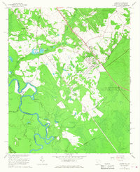
1965 Map of Jackson
USGS Topo · Published 1967About this map
The Savannah River winds along the western edge of this mid-1960s survey, marking the boundary between South Carolina and Georgia. This area is dominated by the massive U S Reservation Savannah River Plant, a restricted industrial zone that reshaped the local geography during the Cold War. North of the reservation, the town of Jackson serves as a primary hub, alongside smaller settlements like Kathwood, Hankinson, and Cowden. The landscape is a mix of agricultural clearings and dense woods, dotted with rural spiritual centers such as Matlock Ch and Thomas Grove Ch. The Seaboard Coast Line railroad cuts diagonally across the terrain, paralleling the river's path. Further south, the river creates complex waterways like Spanish Cut and Holmes Dead River, while the Rhodes Mound stands as a notable landmark in the floodplain, hinting at deeper layers of local history.
Find a feature on this map
48 named features on this map. Tap any name to fly to it.
Don’t see what you’re looking for? This feature index may not catch every label — zoom into the map to look around manually.
Map Details
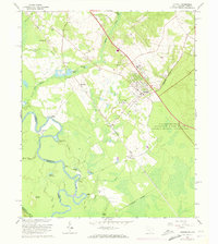
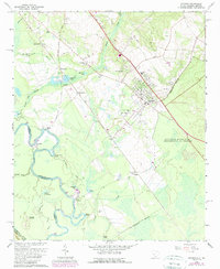
Editions of this 1965 Jackson Map
3 editions found
Other maps of this area

1920 · Ellenton
USGS Topo · 1:48,000

1920 · Greens Cut
USGS Topo · 1:62,500

1920 · Talatha
USGS Topo · 1:48,000

1921 · Augusta
USGS Topo · 1:62,500

1921 · Talatha
USGS Topo · 1:62,500

1921 · Ellenton
USGS Topo · 1:62,500

1943 · Greens Cut
USGS Topo · 1:62,500

1943 · Augusta East
USGS Topo · 1:125,000

1943 · Talatha
USGS Topo · 1:62,500

1943 · Augusta
USGS Topo · 1:62,500