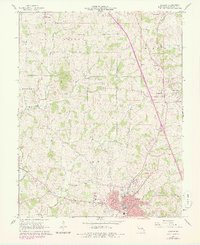
1966 Map of Jackson
USGS Topo · Published 1978About this map
The Cape Girardeau County seat of Jackson serves as the focal point of this survey, showing a network of established roads like Main St and Washington St intersecting with the Missouri Pacific railroad. The surrounding landscape is defined by the Byrd Hills and a dense collection of family cemeteries, including the Clippard Cem, Wheeler Cem, and Ramsey Cem, which offer significant value for genealogical research.
Find a feature on this map
49 named features on this map. Tap any name to fly to it.
Don’t see what you’re looking for? This feature index may not catch every label — zoom into the map to look around manually.
Map Details
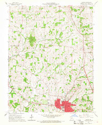
Editions of this 1966 Jackson Map
2 editions found
Other maps of this area

1918 · Altenburg
USGS Topo · 1:62,500

1922 · Cape Girardeau
USGS Topo · 1:62,500

1923 · Perryville
USGS Topo · 1:62,500

1924 · Cape Girardeau
USGS Topo · 1:62,500

1924 · Perryville
USGS Topo · 1:62,500

1925 · Altenburg
USGS Topo · 1:62,500

1933 · Marble Hill
USGS Topo · 1:62,500

1937 · Marble Hill
USGS Topo · 1:62,500

1947 · Oak Ridge
USGS Topo · 1:24,000

1947 · Altenburg
USGS Topo · 1:62,500