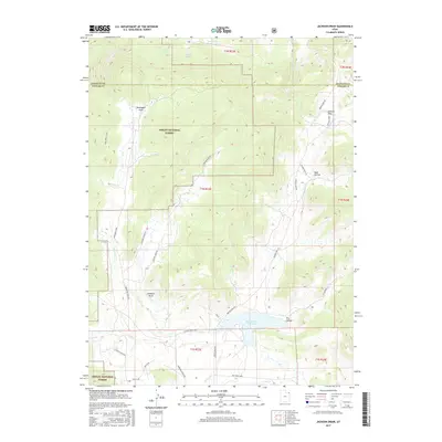
2017 Map of Jackson Draw
USGS Topo · Published 2017About this map
Ashley National Forest dominates this section of the Uintah and Daggett county border, where a network of ranch roads and drainages defines the high-country landscape. This 2017 survey details a remote interior of Northeastern Utah where names like Slaugh Ranch Rd, Workman Ranch Rd, and Hacking Ranch Rd signal the region's enduring ranching heritage. The topography is deeply incised by numerous draws and hollows, most notably Jackson Draw and Davenport Draw, which funnel seasonal water toward larger systems. Significant water resources such as the Matt Warner Reservoir provide critical focal points in an otherwise arid terrain. Remote access points like the Pipe Creek Trail and various creek systems, including Little Davenport Cr and Pot Cr, trace the natural movement of water and livestock across these federal lands.
Find a feature on this map
33 named features on this map. Tap any name to fly to it.
Don’t see what you’re looking for? This feature index may not catch every label — zoom into the map to look around manually.
Map Details
Editions of this 2017 Jackson Draw Map
This is the sole edition of this map. No revisions or reprints were ever made.
Other maps of this area

1885 · Ashley
USGS Topo · 1:250,000

1950 · Burnt Cabin Gorge
USGS Topo · 1:24,000

1950 · Blair Basin
USGS Topo · 1:24,000

1952 · Warren Draw
USGS Topo · 1:24,000

1952 · Clay Basin
USGS Topo · 1:24,000

1952 · Dutch John Mtn
USGS Topo · 1:24,000

1952 · Goslin Mtn
USGS Topo · 1:24,000

1954 · Vernal
USGS Topo · 1:250,000

1958 · Vernal
USGS Topo · 1:250,000

1960 · Vernal
USGS Topo · 1:250,000