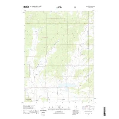
2020 Map of Jackson Draw
USGS Topo · Published 2020About this map
Ashley National Forest dominates this northeastern corner of Utah, where the high-altitude landscape is defined by deep draws and cattle ranching infrastructure. The map reveals a network of rural access routes named for local families and operations, including Siddoway Ranch Rd, Hacking Ranch Rd, and Slaugh Ranch Rd. These roads navigate the complex drainage systems of Lambson Draw and Davenport Draw, which feed into the area's vital water sources. To the south, Matt Warner Reservoir serves as a prominent landmark on Pot Cr, surrounded by significant grazing lands marked by a miles-long Fence Line. This 2020 survey documents the modern state of these working lands, tracing the paths of Jackson Cr and Simons Cr through the high country along the border of Daggett and Uintah counties.
Find a feature on this map
29 named features on this map. Tap any name to fly to it.
Don’t see what you’re looking for? This feature index may not catch every label — zoom into the map to look around manually.
Map Details
Editions of this 2020 Jackson Draw Map
This is the sole edition of this map. No revisions or reprints were ever made.
Other maps of this area

1885 · Ashley
USGS Topo · 1:250,000

1950 · Burnt Cabin Gorge
USGS Topo · 1:24,000

1950 · Blair Basin
USGS Topo · 1:24,000

1952 · Warren Draw
USGS Topo · 1:24,000

1952 · Clay Basin
USGS Topo · 1:24,000

1952 · Dutch John Mtn
USGS Topo · 1:24,000

1952 · Goslin Mtn
USGS Topo · 1:24,000

1954 · Vernal
USGS Topo · 1:250,000

1958 · Vernal
USGS Topo · 1:250,000

1960 · Vernal
USGS Topo · 1:250,000