
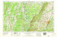
1962 Map of Jackson
USGS Topo · Published 1962About this map
The Mississippi River and Yazoo River define the shifting geography of this region during the early 1960s, a landscape where river navigation, agriculture, and emerging petroleum industries intersect. The capital city of Jackson stands as a significant educational hub, home to institutions like Jackson State College, Millsaps College, and Belhaven College. To the west, the strategic bluffs at Vicksburg remain anchored by the Vicksburg National Military Park, while the surrounding Delta lands are dotted with numerous oxbow lakes such as Eagle Lake and Lake Providence, which speak to the river's historic meanderings.
Find a feature on this map
394 named features on this map. Tap any name to fly to it.
Don’t see what you’re looking for? This feature index may not catch every label — zoom into the map to look around manually.
Map Details
Editions of this 1962 Jackson Map
2 editions found
Other maps of this area

1903 · Jackson
USGS Topo · 1:125,000

1905 · Jackson
USGS Topo · 1:48,000

1906 · Florence
USGS Topo · 1:62,500

1908 · Jackson
USGS Topo · 1:62,500

1908 · Florence
USGS Topo · 1:62,500

1909 · Delta Bridge
USGS Topo · 1:24,000

1909 · Lake Bruen
USGS Topo · 1:24,000

1909 · Baxter Bayou
USGS Topo · 1:24,000

1909 · Millikens Bend
USGS Topo · 1:24,000

1909 · Lake Providence
USGS Topo · 1:24,000