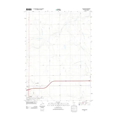
2013 Map of Jackson NW
USGS Topo · Published 2013About this map
The Des Moines River winds through the southwestern corner of this quadrangle, anchoring the city of Jackson, where local life is defined by civic landmarks and transportation hubs. This 2013 survey reveals a landscape shaped by both natural drainage and deliberate engineering, with the S Fork Elm Cr and a series of managed waterways like County Ditch Number Fourteen and Judicial Ditch Number Fifteen cutting through the agricultural grid. On the outskirts of the city, the Jackson County Fairgrounds and the Jackson Speedway serve as regional gathering points, while the Jackson Municipal Airport and the corridor of Us-71 facilitate travel and commerce. The map provides a clear view of how public infrastructure and water management systems have organized the Jackson County terrain over time.
Find a feature on this map
27 named features on this map. Tap any name to fly to it.
Don’t see what you’re looking for? This feature index may not catch every label — zoom into the map to look around manually.
Map Details
Editions of this 2013 Jackson NW Map
This is the sole edition of this map. No revisions or reprints were ever made.
Other maps of this area

1954 · Fairmont
USGS Topo · 1:250,000

1958 · Fairmont
USGS Topo · 1:250,000

1970 · Jackson NW
USGS Topo · 1:24,000

1970 · Lakefield NE
USGS Topo · 1:24,000

1970 · Jackson
USGS Topo · 1:24,000

1970 · Mountain Lake SE
USGS Topo · 1:24,000

1970 · Lakefield SE
USGS Topo · 1:24,000

1970 · Windom
USGS Topo · 1:24,000
1970 · Bergen
USGS Topo · 1:24,000

1970 · Dunnell
USGS Topo · 1:24,000