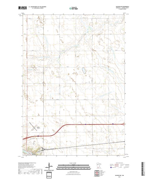
2022 Map of Jackson NW
USGS Topo · Published 2022About this map
Jackson anchors the southern edge of this Minnesota landscape, situated where the Des Moines River winds past State St and Riverside Dr. The map documents a heavily managed agricultural environment north of the city, defined by a complex network of man-made waterways such as County Ditch Number Fourteen and Judicial Ditch Number Thirtytwo. These features, alongside the natural path of the S Fork Elm Cr, illustrate the extensive drainage efforts required to sustain the regional farming economy. Toward the center of the sheet, the Jackson Municipal Airport stands near the intersection of several county roads, while the broader township structure is delineated by the boundaries of t103n r35w and t103n r34w. The northern reaches of the quadrangle show the convergence of the E Fork Des Moines River amidst a grid of rural routes including 870th St and 560th Ave.
Find a feature on this map
34 named features on this map. Tap any name to fly to it.
Don’t see what you’re looking for? This feature index may not catch every label — zoom into the map to look around manually.
Map Details
Editions of this 2022 Jackson NW Map
This is the sole edition of this map. No revisions or reprints were ever made.
Other maps of this area

1954 · Fairmont
USGS Topo · 1:250,000

1958 · Fairmont
USGS Topo · 1:250,000

1970 · Jackson NW
USGS Topo · 1:24,000

1970 · Lakefield NE
USGS Topo · 1:24,000

1970 · Jackson
USGS Topo · 1:24,000

1970 · Mountain Lake SE
USGS Topo · 1:24,000

1970 · Lakefield SE
USGS Topo · 1:24,000

1970 · Windom
USGS Topo · 1:24,000
1970 · Bergen
USGS Topo · 1:24,000

1970 · Dunnell
USGS Topo · 1:24,000