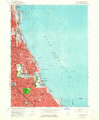
1963 Map of Jackson Park
USGS Topo · Published 1964About this map
Lake Michigan dominates the eastern half of this study, its shoreline defined by massive civic engineering projects and the leisure infrastructure of Chicago. From the Shedd Aquarium and Adler Planetarium on Northerly Island down to the South Shore Country Club, the lakefront is a continuous corridor of parks and landmarks. The map documents the dense urban grid of the South Side, anchored by institutions such as the University of Chicago and the sprawling Oak Woods Cemetery. Transport networks like the Illinois Central and Lake Shore Drive parallel the coast, facilitating the movement that shaped this era of the city. Notable cultural hubs are clearly marked, including Soldier Field, the Natural History Museum, and the Museum of Science and Industry situated within Jackson Park.
Find a feature on this map
117 named features on this map. Tap any name to fly to it.
Don’t see what you’re looking for? This feature index may not catch every label — zoom into the map to look around manually.
Map Details
Editions of this 1963 Jackson Park Map
3 editions found
Other maps of this area

1889 · Chicago
USGS Topo · 1:62,500

1891 · Chicago
USGS Topo · 1:62,500

1892 · Calumet
USGS Topo · 1:62,500

1893 · Calumet
USGS Topo · 1:62,500

1900 · Chicago
USGS Topo · 1:62,500

1900 · Toleston
USGS Topo · 1:62,500

1900 · Calumet
USGS Topo · 1:62,500

1901 · Calumet
USGS Topo · 1:62,500

1901 · Chicago
USGS Topo · 1:62,500

1929 · Calumet Lake
USGS Topo · 1:24,000