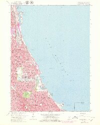
1963 Map of Jackson Park
USGS Topo · Published 1979About this map
The Lake Michigan shoreline of Chicago dominates this map, showcasing a densely developed urban landscape defined by public parks, monumental cultural institutions, and major transit corridors. Along the waterfront, the legacy of city planning is evident in the continuous green space of Burnham Park and Jackson Park, which house significant landmarks like the Natural History Museum and the Museum of Science and Industry. The map illustrates a period of mid-century infrastructure, featuring the active Meigs Field on Northerly Island and the proximity of the Illinois Central Railroad to the lakefront. Inland, the grid of the South Side is peppered with numerous parochial schools and community institutions, such as Hales Franciscan High Sch and the expansive Oakwoods Cemetery. The presence of the University of Chicago and its Midway Plaisance provides a structured anchor to the Hyde Park neighborhood, contrasting with the industrial and transportation hubs found further north and south.
Find a feature on this map
109 named features on this map. Tap any name to fly to it.
Don’t see what you’re looking for? This feature index may not catch every label — zoom into the map to look around manually.
Map Details
Editions of this 1963 Jackson Park Map
3 editions found
Other maps of this area

1889 · Chicago
USGS Topo · 1:62,500

1891 · Chicago
USGS Topo · 1:62,500

1892 · Calumet
USGS Topo · 1:62,500

1893 · Calumet
USGS Topo · 1:62,500

1900 · Chicago
USGS Topo · 1:62,500

1900 · Toleston
USGS Topo · 1:62,500

1900 · Calumet
USGS Topo · 1:62,500

1901 · Calumet
USGS Topo · 1:62,500

1901 · Chicago
USGS Topo · 1:62,500

1929 · Calumet Lake
USGS Topo · 1:24,000