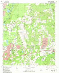
1980 Map of Jackson SE
USGS Topo · Published 1980About this map
The Pearl River and its associated floodplains define the western corridor of this Rankin County landscape, marking the transition between the state capital and the growing suburban reaches of Pearl and Flowood. This era represents a period of significant regional infrastructure, anchored by the sprawling Thompson Field and the expansive Ross R Barnett Reservoir Elevation 298 to the northeast. Transportation and industrial development are evident through the Illinois Central Gulf Railroad lines and numerous resource extraction sites like the Quarries near Greenfield. Local genealogy and community life are well-documented through small country landmarks such as Drakes Ch, Sweet Home Ch, and cemeteries including Whittington Cem and Flora Hills Cem. The map captures a mix of residential expansion in Crossgates and Castlewoods alongside established facilities like the Riverside Hospital and Womans Hospital.
Find a feature on this map
64 named features on this map. Tap any name to fly to it.
Don’t see what you’re looking for? This feature index may not catch every label — zoom into the map to look around manually.
Map Details
Editions of this 1980 Jackson SE Map
2 editions found
Other maps of this area

1903 · Jackson
USGS Topo · 1:125,000

1905 · Jackson
USGS Topo · 1:48,000

1906 · Florence
USGS Topo · 1:62,500

1908 · Jackson
USGS Topo · 1:62,500

1908 · Florence
USGS Topo · 1:62,500

1922 · Pelahatchee
USGS Topo · 1:48,000

1924 · Pelahatchee
USGS Topo · 1:62,500

1950 · Pelahatchie
USGS Topo · 1:62,500

1952 · Pelahatchie
USGS Topo · 1:62,500

1953 · Meridian
USGS Topo · 1:250,000