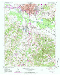
1950 Map of Jackson South
USGS Topo · Published 1983About this map
The industrial and academic center of Jackson anchors this 1950s landscape, where the Gulf Mobile And Ohio and Illinois Central railroads converge. Educational landmarks like Union University, Lambuth College, and Whitehall Sch define the northern city streets, while the southern reaches transition into the company town atmosphere of Bemis and the crossroads at Malesus. The rail infrastructure is extensive, featuring the Frogmoor Yards and Iselin Station, illustrating the city's role as a major regional transportation hub during the mid-20th century.
Find a feature on this map
66 named features on this map. Tap any name to fly to it.
Don’t see what you’re looking for? This feature index may not catch every label — zoom into the map to look around manually.
Map Details
Editions of this 1950 Jackson South Map
5 editions found
Other maps of this area

1950 · Jackson South
USGS Topo · 1:24,000

1950 · Jackson North
USGS Topo · 1:24,000

1951 · Jackson North
USGS Topo · 1:24,000

1953 · Claybrook
USGS Topo · 1:24,000

1953 · Beech Bluff
USGS Topo · 1:24,000

1956 · Blytheville
USGS Topo · 1:250,000

1959 · Blytheville
USGS Topo · 1:250,000

1959 · Westover
USGS Topo · 1:24,000

1959 · Adair
USGS Topo · 1:24,000

1961 · Medon
USGS Topo · 1:24,000