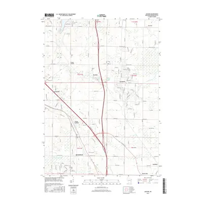
2015 Map of Jackson
USGS Topo · Published 2015About this map
Jackson and the surrounding townships in Washington County are characterized by a dense network of early settlements and small family cemeteries. This mid-2010s survey illustrates a landscape where modern infrastructure meets historical rural foundations, visible at Rugby Junction and the small cluster of Dheinsville. The terrain is punctuated by significant water features including Little Cedar Lake in the northwest and Hasmer Lake near the center of the sheet. For genealogists, the map provides precise locations for numerous small burial grounds, such as Maxon Cem, Last Home Cem, and Erler Cem, which are often the only remaining markers of the area's pioneer farmsteads. The southern portion of the quadrangle shows the headwaters of the Oconomowoc River as it begins its course through Richfield.
Find a feature on this map
127 named features on this map. Tap any name to fly to it.
Don’t see what you’re looking for? This feature index may not catch every label — zoom into the map to look around manually.
Map Details
Editions of this 2015 Jackson Map
This is the sole edition of this map. No revisions or reprints were ever made.
Other maps of this area

1892 · Waukesha
USGS Topo · 1:62,500

1892 · Oconomowoc
USGS Topo · 1:62,500

1901 · Waukesha
USGS Topo · 1:62,500

1904 · West Bend
USGS Topo · 1:62,500

1904 · Hartford
USGS Topo · 1:62,500

1906 · Waukesha
USGS Topo · 1:62,500

1909 · Oconomowoc
USGS Topo · 1:62,500

1957 · Madison
USGS Topo · 1:250,000
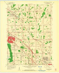
1958 · Menomonee Falls
USGS Topo · 1:24,000

1959 · West Bend
USGS Topo · 1:62,500