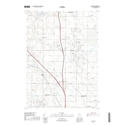
2018 Map of Jackson
USGS Topo · Published 2018About this map
Little Cedar Lake and the winding course of Cedar Creek define this portion of Washington County, where suburban expansion meets long-standing rural hamlets. The landscape is dotted with small family and parish burial grounds, including the Maxon Cem and Last Home Cem, reflecting the early settlement patterns of the region. Transportation corridors serve as the backbone of the area, connecting the larger hubs of Jackson and Slinger with historic stopovers like Mayfield and the rail-oriented Rugby Junction.
Find a feature on this map
134 named features on this map. Tap any name to fly to it.
Don’t see what you’re looking for? This feature index may not catch every label — zoom into the map to look around manually.
Map Details
Editions of this 2018 Jackson Map
This is the sole edition of this map. No revisions or reprints were ever made.
Other maps of this area

1892 · Waukesha
USGS Topo · 1:62,500

1892 · Oconomowoc
USGS Topo · 1:62,500

1901 · Waukesha
USGS Topo · 1:62,500

1904 · West Bend
USGS Topo · 1:62,500

1904 · Hartford
USGS Topo · 1:62,500

1906 · Waukesha
USGS Topo · 1:62,500

1909 · Oconomowoc
USGS Topo · 1:62,500

1957 · Madison
USGS Topo · 1:250,000
1958 · Menomonee Falls
USGS Topo · 1:24,000

1959 · West Bend
USGS Topo · 1:62,500