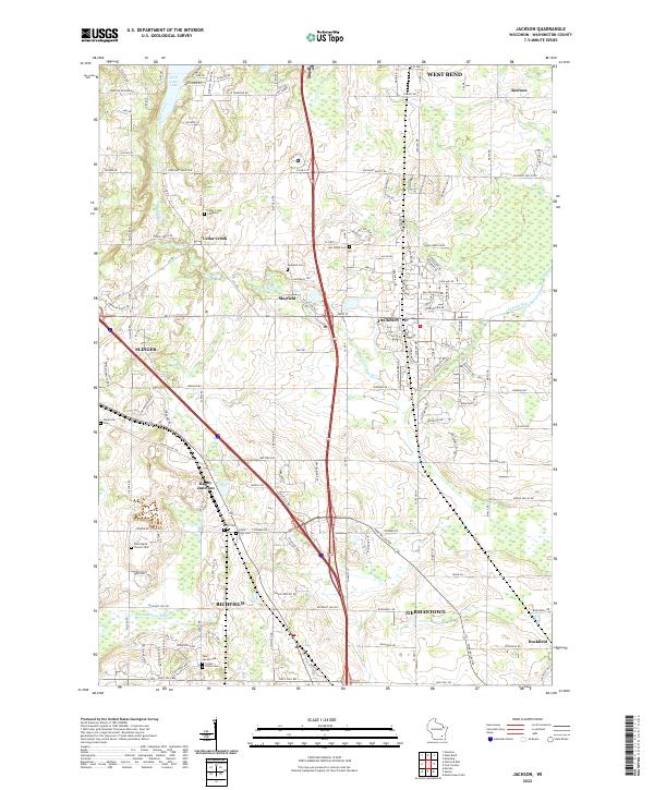
2022 Map of Jackson
USGS Topo · Published 2022About this map
The Oconomowoc River and Cedar Creek drainage basins define the landscape of Washington County in this contemporary survey, where agricultural roots meet expanding transportation corridors. The village of Jackson and the historic settlement of Mayfield sit at the center of the sheet, surrounded by a dense network of country roads including Holy Hill Rd and Fond Du Lac Dr. Significant for genealogists, the map identifies numerous family and community burial sites such as the Cedar Creek Cemetary, Last Home Cem, and Ackerville Cem, providing a clear record of local settlement patterns.
Find a feature on this map
134 named features on this map. Tap any name to fly to it.
Don’t see what you’re looking for? This feature index may not catch every label — zoom into the map to look around manually.
Map Details
Editions of this 2022 Jackson Map
This is the sole edition of this map. No revisions or reprints were ever made.
Other maps of this area

1892 · Waukesha
USGS Topo · 1:62,500

1892 · Oconomowoc
USGS Topo · 1:62,500

1901 · Waukesha
USGS Topo · 1:62,500

1904 · West Bend
USGS Topo · 1:62,500

1904 · Hartford
USGS Topo · 1:62,500

1906 · Waukesha
USGS Topo · 1:62,500

1909 · Oconomowoc
USGS Topo · 1:62,500

1957 · Madison
USGS Topo · 1:250,000
1958 · Menomonee Falls
USGS Topo · 1:24,000

1959 · West Bend
USGS Topo · 1:62,500