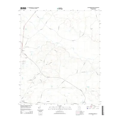
2014 Map of Jacksonboro Bridge
USGS Topo · Published 2014About this map
Brier Creek defines the northern reaches of this Screven County landscape, winding past the historical crossing at Jacksonboro Bridge. This 2014 survey documents the rural character of the region just north of Sylvania, where large tracts of land are primarily accessed by a network of local roads such as Burtons Ferry Hwy and Newington Hwy. The area is marked by numerous family and community landmarks, including the Friendship Memorial Cem and Reddick Cem, which serve as vital touchstones for local genealogical research.
Find a feature on this map
47 named features on this map. Tap any name to fly to it.
Don’t see what you’re looking for? This feature index may not catch every label — zoom into the map to look around manually.
Map Details
Editions of this 2014 Jacksonboro Bridge Map
This is the sole edition of this map. No revisions or reprints were ever made.
Other maps of this area

1918 · Oliver
USGS Topo · 1:62,500

1919 · Shirley
USGS Topo · 1:62,500

1920 · Hilltonia
USGS Topo · 1:62,500

1920 · Oliver
USGS Topo · 1:62,500

1920 · Peeples
USGS Topo · 1:62,500

1943 · Hilltonia
USGS Topo · 1:62,500

1943 · Peeples
USGS Topo · 1:62,500

1943 · Shirley
USGS Topo · 1:62,500

1943 · Millen
USGS Topo · 1:125,000

1943 · Oliver
USGS Topo · 1:62,500