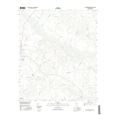
2017 Map of Jacksonboro Bridge
USGS Topo · Published 2017About this map
Brier Creek defines the low-lying wetlands of Screven County, meandering through a landscape shaped by tributary drainages and seasonal ponds. Near the historical crossing at Jacksonboro Bridge, the terrain is a network of water and woods, where Beaverdam Cr and Blue Springs emerge from the wetlands. Further south, the northern outskirts of Sylvania appear at the edge of the survey, signaling the shift toward more developed uplands. This 2017 edition documents the persistent rural character of the region, where family and community heritage is preserved in sites like Reddick Cems and Friendship Memorial Cem. The map provides a detailed view of the local drainage system, from Buck Cr and So Prong Buck Cr to established water bodies like Loriscy Lake and Boddiford Pond, illustrating the hydraulic patterns that have governed land use in this part of Georgia for generations.
Find a feature on this map
57 named features on this map. Tap any name to fly to it.
Don’t see what you’re looking for? This feature index may not catch every label — zoom into the map to look around manually.
Map Details
Editions of this 2017 Jacksonboro Bridge Map
This is the sole edition of this map. No revisions or reprints were ever made.
Other maps of this area

1918 · Oliver
USGS Topo · 1:62,500

1919 · Shirley
USGS Topo · 1:62,500

1920 · Hilltonia
USGS Topo · 1:62,500

1920 · Oliver
USGS Topo · 1:62,500

1920 · Peeples
USGS Topo · 1:62,500

1943 · Hilltonia
USGS Topo · 1:62,500

1943 · Peeples
USGS Topo · 1:62,500

1943 · Shirley
USGS Topo · 1:62,500

1943 · Millen
USGS Topo · 1:125,000

1943 · Oliver
USGS Topo · 1:62,500