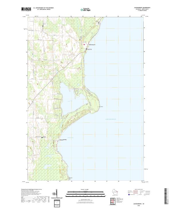
2022 Map of Jacksonport
USGS Topo · Published 2022About this map
Jacksonport sits at the heart of this Door County peninsula landscape, where the waters of Lake Michigan meet a complex shoreline of bays and points. The terrain is defined by the prominent reach of Cave Point and the sheltered waters of Whitefish Bay, while inland, Hibbard Creek drains toward the coast. Local genealogy is well-documented through a series of denominational and community burial grounds, including Zion Lutheran Cem, Saint Michael Catholic Cem, and the Holy Nativity Cem. The transition from the lakefront to the interior is marked by several significant water bodies such as Clark Lake, Arhter Lake, and Schwartz Lake. A dense network of county and local roads, such as Co Rd V and Plum Bottom Rd, connects these coastal settlements to the surrounding timber and agricultural sections.
Find a feature on this map
50 named features on this map. Tap any name to fly to it.
Don’t see what you’re looking for? This feature index may not catch every label — zoom into the map to look around manually.
Map Details
Editions of this 2022 Jacksonport Map
This is the sole edition of this map. No revisions or reprints were ever made.
Other maps of this area

1954 · Escanaba
USGS Topo · 1:250,000

1954 · Manitowoc
USGS Topo · 1:250,000

1957 · Escanaba
USGS Topo · 1:250,000

1958 · Escanaba
USGS Topo · 1:250,000

1958 · Manitowoc
USGS Topo · 1:250,000

1960 · Sturgeon Bay
USGS Topo · 1:62,500

1960 · Jacksonport
USGS Topo · 1:62,500

1960 · Sister Bay
USGS Topo · 1:62,500

1961 · Chambers Island
USGS Topo · 1:62,500

1981 · Institute
USGS Topo · 1:24,000