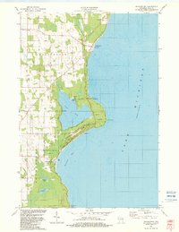
1982 Map of Jacksonport
USGS Topo · Published 1982About this map
Jacksonport anchors this eastern Door County shoreline, serving as a hub for the surrounding coastal landscape in the early 1980s. The map illustrates a concentration of community landmarks, including the Zion Ch and Holy Nativity Ch, along with several historic burial grounds such as Zion Cem and the Jacksonport Lakeview Cem. The geography is defined by the proximity of Lake Michigan, which shapes the character of the inland water bodies like Clark Lake and Schwartz Lake.
Find a feature on this map
31 named features on this map. Tap any name to fly to it.
Don’t see what you’re looking for? This feature index may not catch every label — zoom into the map to look around manually.
Map Details
Editions of this 1982 Jacksonport Map
This is the sole edition of this map. No revisions or reprints were ever made.
Other maps of this area

1954 · Escanaba
USGS Topo · 1:250,000

1954 · Manitowoc
USGS Topo · 1:250,000

1957 · Escanaba
USGS Topo · 1:250,000

1958 · Escanaba
USGS Topo · 1:250,000

1958 · Manitowoc
USGS Topo · 1:250,000

1960 · Sturgeon Bay
USGS Topo · 1:62,500

1960 · Jacksonport
USGS Topo · 1:62,500

1960 · Sister Bay
USGS Topo · 1:62,500

1961 · Chambers Island
USGS Topo · 1:62,500

1981 · Institute
USGS Topo · 1:24,000